Registration
Registration will resume onsite on
Saturday, June 17, 2017 at 12pm Register for the Convention NSS 2017 WNS Decontamination Protocol Information Registered Attendees Refund Policy
Saturday, June 17, 2017 at 12pm Register for the Convention NSS 2017 WNS Decontamination Protocol Information Registered Attendees Refund Policy
Lodging and Transportation
Sessions & Salons
Convention Trips
Local Attractions


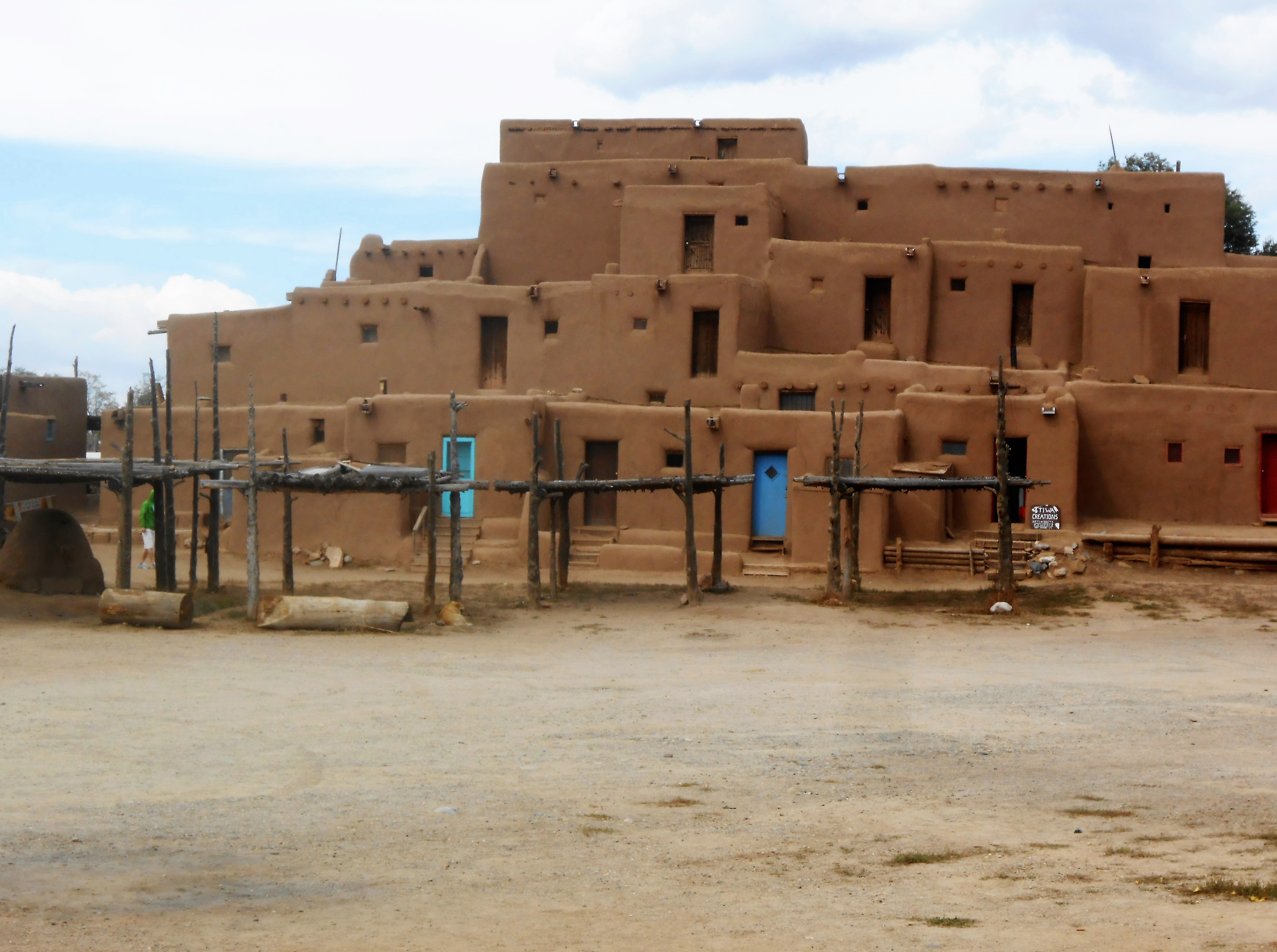
World Heritage Sites New Mexico is the top state in the U.S. for having the most World Heritage Sites. The World Heritage Site program is intended to bring recognition to and encourage preservation of the best of both human-built and natural places around the globe. One writer referred to these spots as the “World’s Greatest Hits.” We happen to have four of these hits in New Mexico: Carlsbad Caverns National Park, Chaco Culture National Historical Park, Taos Pueblo, and White Sands National Monument. Cavers and their families and friends can make an excursion to at least two of these places (Taos Pueblo and Chaco Culture NHP) within a day’s outing from the convention site. Entry to any of these areas is inexpensive and plenty worthwhile. You will agree they are worth protecting for future generations. While in Taos, make it a point to visit the EarthShip dwellings and the breathtaking Rio Grande Gorge, where kayakers and rafters can be observed making their way down river. Good eyes might spot a raptor or two nesting nearby or flying past.
Summer Solstice, June 21st We should have the best of New Mexico’s dark skies all during convention week. However, bring your own telescope or join the Albuquerque Astronomy Club for a Star Party in the parking lot of the Santa Ana Star Center. (Alternatively, there may be a possible field trip to the UNM Observatory in Albuquerque.)
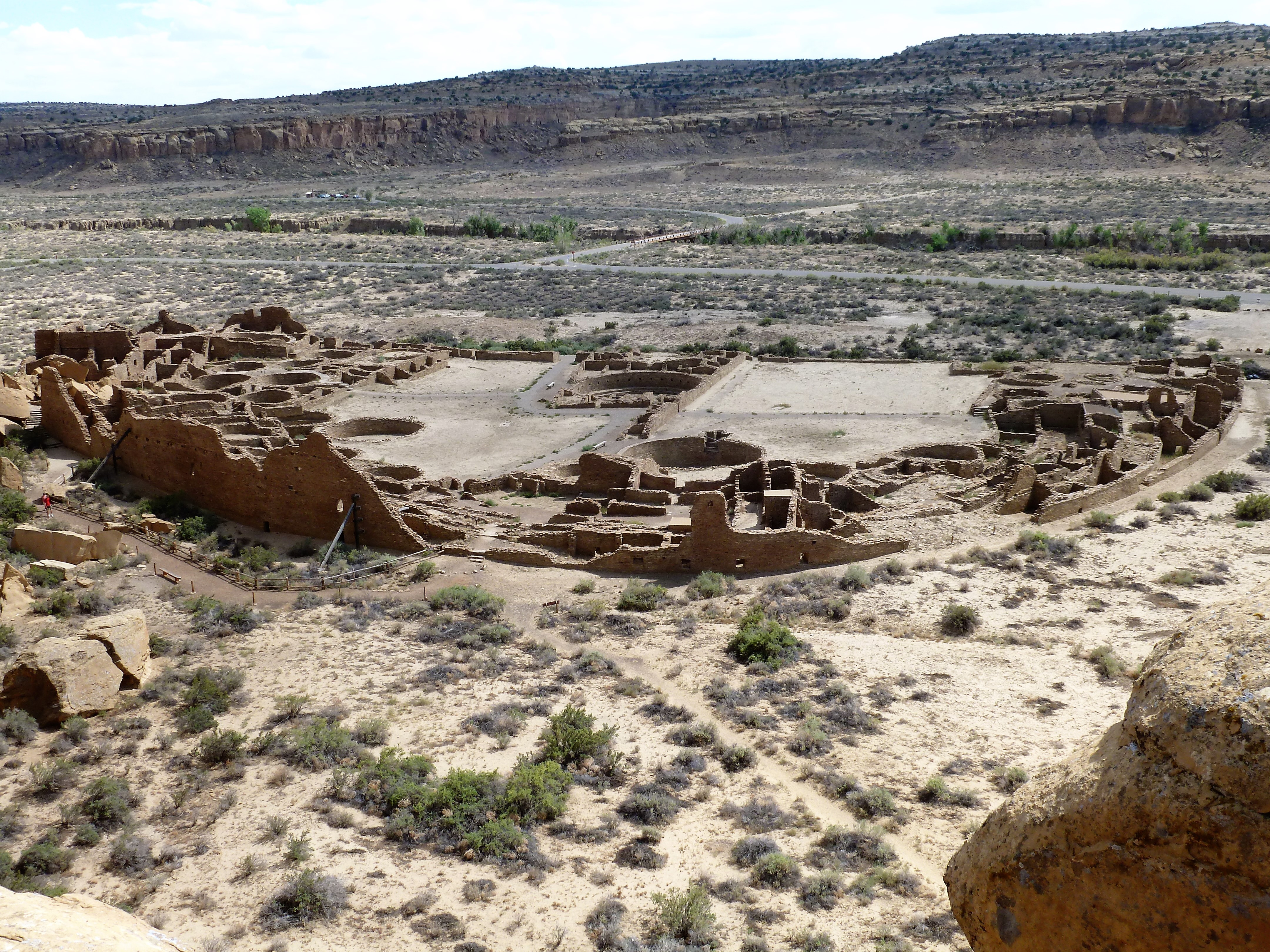
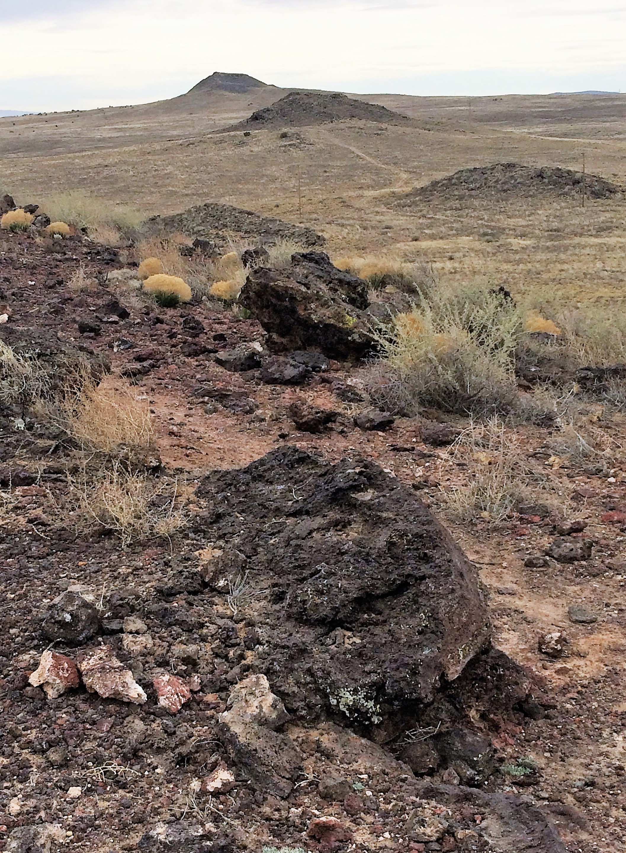
Speaking of astronomy, Chaco Canyon’s ancient builders had a keen sense of timing and astronomy, lining up several of their sites in tune with nature. Rangers lead sunrise tours if you want to make a two-hour drive on Solstice to observe the sunrise at Casa Rinconada as the sun shines through windows of this great kiva structure. During the day, visitors can take the nine mile driving loop, stopping at Pueblo Bonito and other great houses of the canyon. The loop is also bicycle friendly. A short jaunt at Kin Kletso leads one up a thrilling trail through a narrow fissure to the top of the mesa and Pueblo Alto, past Chacoan stairs and old roads that were part of a vast trading network. Farther on, at the cliff face overlook, one observes the vast Pueblo Bonito, Chaco’s centerpiece structure built between AD 850 and 1150. El Camino Real and Jornada del MuertoIf cavers and families are traveling to Rio Rancho from the South along I-10 and then up I-25, they can exit the highway for a stop above the Rio Grande at the El Camino Real International Heritage Center and an overlook of the remarkable vista of the Jornada del Muerto. In Spanish colonial days, New Mexico’s chief line of communication with the outside world was the Royal Road or King’s Highway, which connected Santa Fe with the regal capital of Mexico City. The route crossed the central New Mexico desert along an arid, level plain, a 90-mile trek.The road was first traveled by Don Juan de Oñate, founder and first governor of the province of New Mexico in 1598, when he directed colonists in a walking caravan of carts and wagons pulled by oxen from his mining home in Zacatecas, Mexico. He founded San Gabriel on the western banks of the Rio Grande overlooking the Espanola Valley, a few hundred miles north. Just a few miles north, Civil War buffs can stop at Fort Craig National Historic Site, home of the Buffalo Soldiers and a Union Army supply depot, near where the Battle of Valverde was fought with Sibley’s Confederate troops in 1862. Albuquerque Volcanoes and Petroglyph National Monument Nearing Albuquerque’s west side mesas, you might observe or choose to hike among five volcanic cinder cones, formed 150,000 years ago. These cones rise above Petroglyph National Monument, a boulder-strewn volcanic escarpment used by Native Americans and early settlers, where over 20,000 fantastic displays of rock art are preserved. The City of Albuquerque manages a trail system beside this sacred landscape of the Three Sisters, a classic and rare example of fissure eruption across the middle of the Rio Grande Rift Valley. Pueblo Indians of the Rio Grande Valley regard the volcanoes and petroglyphs as one of the last remaining untarnished sacred sites in the area. The pecked art provides a direct spiritual connection to their ancestors and to the Spirit World.
Coronado Historic SiteAfter turning onto U.S. 550 from I-25, visitors enter the small town of Bernalillo, founded by Spanish settlers in 1695, but long a trading center for Pueblo Indians. Before closing in on our NSS convention headquarters, our guests can take a slight detour north after passing the RailRunner station and crossing the Rio Grande to visit ruins of the ancient pueblo village of Kuaua (kwa-wa), established about 1325 and occupied for more than 300 years, until Spanish explorer Francisco Vásquez de Coronado’s conquistadors arrived in 1540 and ravaged native tribes with European diseases and forced culture change. A splendid museum and restored kiva explains the site. Ceramic and botanic artifacts unearthed from nearby campgrounds trace early inhabitants to 3000 B.C.Other Nearby ResourcesWhite Mesa (aka Mesa Blanca) spring deposits lie along a boundary zone between the Colorado Plateau and Rio Grande Rift as visitors head northwest toward Cuba and Farmington from the Star Center. These spring deposits resemble a mini-Mammoth Hot Springs of Yellowstone. Trails thread around the Mesa and provide loads of fun and scenic pleasure to hikers and mountain bikers. The Geology Field Trip will visit, among other intriguing sites, some of these spring deposits and several small tufa caves are located nearby.Continuing northwest along U.S. 550, the Ojito Wilderness (one of New Mexico’s latest congressionally declared Wilderness areas) is composed of deep, meandering arroyos that offer miles of rugged terrain, and rocky moonscape soils in which to wander. Colorful rock layers in canyon walls and cliffs enhance sightseeing and photography. Be aware of the scarce water supply that made it tough for human cultures to settle here, although several types of ruins display evidence of past human existence. Fossil remains of rare dinosaurs, plants and trees have been discovered here, found in the 150-million-year-old Jurassic Age Morrison Formation. From almost anywhere at elevation in the Ojito Wilderness or along White Mesa, there is a tremendous vista to the north of Cabezon Peak off in the distance. Cabezon means giant head. A Native American origin story tells of a severed head of a giant slain on Mount Taylor, an 11,000+ foot sacred mountain to the west. If travelers continue along US 550 toward Cuba and eventually Chaco Canyon, they can access this outstanding volcanic neck that is frequented by rock climbers and hikers. Up close, it resembles Devil’s Tower. Turning north on NM Highway 4 at San Ysidro and the winemaking community of Ponderosa can be accessed on Hwy 290. Crossing the Jemez River, travelers pass through Jemez Pueblo (now called Walatowa) and note the stunning crimson colored Red Rocks. Stop for a Navajo taco, scrumptious Indian bread hot out of the horno or fried bread and visit with Pueblo people here and at Walatowa Trading Post across the road. Continuing up NM 4, drivers come to Hwy 485 and pass through small towns of Canon and Gilman following the Guadalupe River. You are surrounded by striking mesas. Soon you will drive along the Rio Guadalupe’s cascading waterfalls to the Gilman Tunnels, where scenes from The Lone Ranger were filmed. Climb through some of the oldest rocks in the Jemez Mountains as the canyon narrows at the Guadalupe Box. The tunnels were blasted in the 1920s for a logging railroad and are quite high. Several spectacular turnouts offer access to the falls and a place to cool off in hot summer weather. The pavement ends, but a dirt forest road eventually connects to paved Hwy 126 and returns to Hwy 4. Farther along Highway 4, several miles north of the friendly, but speed-trap town of Jemez Springs, drivers pass the historic Jemez State Monument, a restored Pueblo mission. A large gravel parking lot lets traffic stop for recreation at Soda Dam, where mineral deposits formed small shelter caves and damned up the Jemez River, which pours through a play spot alongside. A trail down to the river and up the other side leads to Spence Hot Springs at an elevation of 7,350 ft. This area provides soaking and further hiking. However, nudity is considered a violation of state law. Continuing up Highway 4, you come to a Y at NM 126, La Cueva, which leads to tremendous fishing at Fenton Lake State Park. Nevertheless, as you proceed along Hwy 4 winding through Santa Fe National Forest lands, Valles Caldera National Preserve lies before you. The 137-mile-wide caldera is the third largest in the world and one of seven supervolcanoes, including Yellowstone. The Valle Grande is the grass valley within the caldera. This valley is the first land management trust in the nation, now transformed by the National Park Service. Throughout the landscape are hot springs, fumaroles, steam vents and volcanic domes, hiking trails and wildlife (including the state’s second largest elk herd. Farther along the highway, visitors arrive at the astonishing Bandelier National Monument, where extensive 12th century pueblo cliff dwellings, pictographs and petroglyphs and Anasazi ruins abound. Continuing, you pass Los Alamos National Labs (birthplace of the Manhattan Project) and soon end up in Santa Fe. To make a marvelous loop journey from a full day, your last stop before returning to reality, whatever that may be, is Kasha-Katuwe Tent Rocks National Monument, west of I-25. Wavy, 1,000-foot-thick deposits of soft pumice and Bandelier tuff radiate sunlight and warmth in the narrow, cool, airy canyons. Catch glimpses of the strange giants: the hoodoos. When climbing to the top along trails, one gets a feeling of being reborn. These canyons form in ash from volcanic eruptions along the Valles Caldera. Whatever you do while in New Mexico, don’t miss an opportunity to explore this unforgettable terrain. |
